Remove weather hurricane-maps
article thumbnail

Climate change predictions: Anticipating and adapting to a warming world

IBM Journey to AI blog

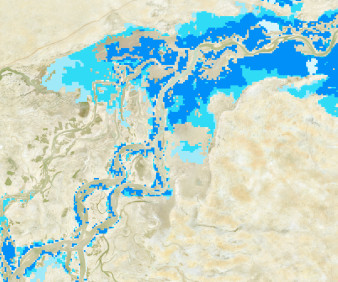
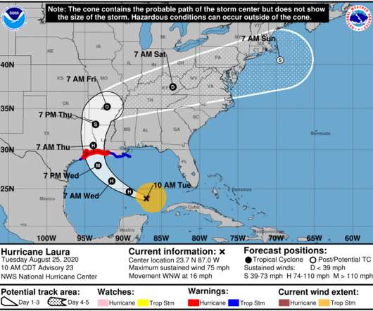
The collaboration is currently focused on building an AI-powered foundation model to make climate and weather applications faster and more accurate. The model could potentially be used to identify conditions that raise the risks of wildfires and predict hurricanes and droughts.

article thumbnail

Add Critical Context to Business Data with Geospatial Data and Location Intelligence

Precisely

Weather and traffic patterns span time and space as well, providing tremendously valuable insights for decision-makers who have the right data and tools. By combining real-time weather data with policyholder information, they’re even able to preemptively notify their customers of an impending hurricane, hailstorm, or similar event.

professionals

Sign Up for our Newsletter

This site is protected by reCAPTCHA and the Google Privacy Policy and Terms of Service apply.

article thumbnail

Context is Key: Empowering Business Users With Spatial Analytics and Enriched Data

Precisely

Some offer very limited map visualization capabilities, but they generally don’t go much further than displaying locations on a two-dimensional plane. The goal of visualization is not creating pretty maps – it’s all about deriving information that moves you from “what happened” to “how,” “why,” and “in what context.”

article thumbnail

Open data using AI for climate action

DrivenData Labs

Better estimates of "snow water equivalent" (SWE) from real-time satellite, ground station, and meteorological data helps water managers plan resources and respond to extreme weather events like floods and droughts.

AI 292
article thumbnail

Difficulties reading the cone of uncertainty

FlowingData

It seems that there is always surprise when a hurricane makes landfall in some areas, which some attribute to poor forecast communication with the cone on a map that shows possible paths. Maybe, when it comes to communicating hurricane forecasts, we should get rid of possible-paths maps altogether and focus on possible outcomes.

94
article thumbnail

5 ways organizations are using AI for climate action

DrivenData Labs

Given the diverse landscape and shifting climate, accurate estimates of snow water equivalent (SWE) at a high spatiotemporal resolution are increasingly important to inform water management decisions and help respond to extreme weather events such as floods and droughts.

AI 130
article thumbnail

Why Data Quality and Enrichment Are Critical to Claims Management Digital Transformation

Precisely

A bot can query a historical weather data API to determine whether it hailed on a specific date, at a specific address. The same process can validate other adverse weather events and their severity – such as wind, precipitation, fire, and flooding. Policy, location, and weather data make it all possible. Hail in the forecast?