Remove details biodiversity
article thumbnail

Field Boundaries Detection and Land Cover Classification And How EOSDA Does It

Data Science Dojo

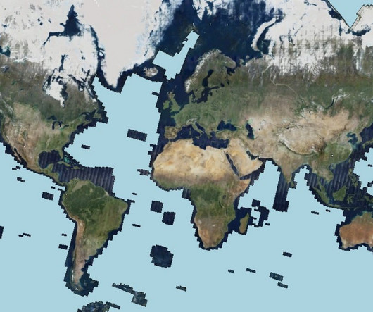
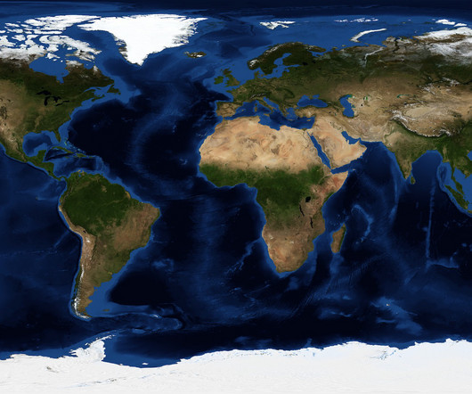
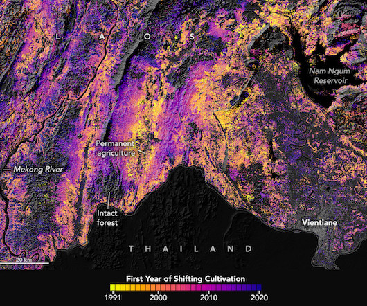
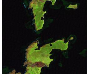
Our ability to classify and monitor these regions with accuracy can influence everything from climate change predictions and biodiversity conservation strategies to urban planning and agricultural productivity optimization. Finally, the output visualizations are prepared according to predefined Area of Interest (AOI) coordinates.

Algorithm 370
article thumbnail

AI2 and Microsoft use satellite images plus artificial intelligence to monitor the planet

Flipboard

“The model tries to combine information across low-resolution images to predict sub-pixel details.” . “We use deep learning models to generate a high-resolution image from many low-resolution images of the same location captured at different times,” Bastani explained.

professionals

Sign Up for our Newsletter

This site is protected by reCAPTCHA and the Google Privacy Policy and Terms of Service apply.

article thumbnail

Master prompt engineering with effective strategies

Data Science Dojo

”, prompt engineering involves crafting a more specific and detailed prompt like “What is the current temperature in New York City?” The choice of words, context, and additional details in the prompt can influence the output of the AI model and ensure it produces accurate and relevant information.

AI 195
article thumbnail

The BirdCLEF 2023 Challenge: Pushing the frontiers of biodiversity monitoring

Google Research AI blog

However, creating high-quality annotated datasets — especially for areas with high biodiversity — can be expensive and tedious, often requiring tens of hours of expert analyst time to annotate a single hour of audio. See the competition website for detailed information on the dataset to be used, timelines, and rules.

ML 79
article thumbnail

5 ways organizations are using AI for climate action

DrivenData Labs

Biodiversity conservation ⚡ Energy efficiency ?️ Biodiversity conservation ¶ The third bucket is focused on how we monitor and protect wildlife populations to determine when and how best to intervene for the sustainability of the world’s ecosystems. Managing natural resources ?️ Disaster resilience ?

AI 130
article thumbnail

The Indian Business Responsibility and Sustainability Report (BRSR) explained

IBM Journey to AI blog

SEBI’s guidance document provides details on three kinds of disclosures—general, management and process, and “principle wise” (principle-based). Leadership indicators also comprise advanced reporting on biodiversity, energy consumption, scope 3 greenhouse gas emissions and supply chain disclosures.

52
article thumbnail

Open Earth Observation Data for the Pale Blue Dot: Visualization Challenge

DrivenData Labs

ASTER data can be used to create detailed maps of land surface temperature, emissivity, reflectance, and elevation. GEDI can be used to construct detailed 3D maps of forest canopies, branches, and leaves, as well as to study animal habitats and biodiversity. ASTER and MODIS are both aboard the Terra satellite.

Python 162